[block_2]
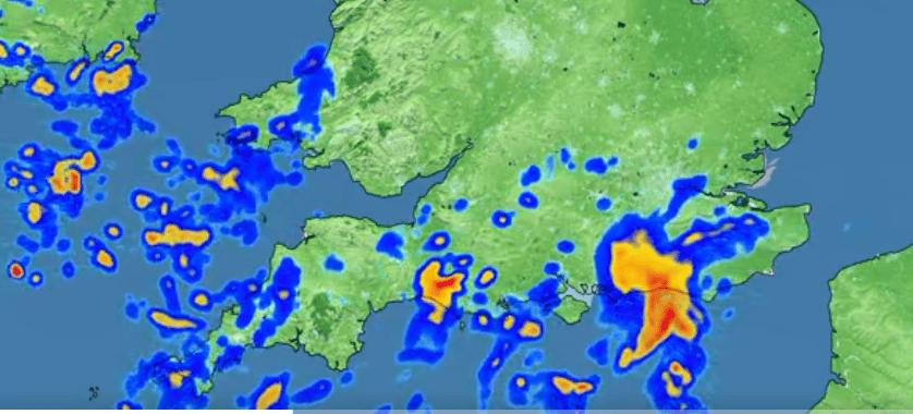
The yellow thunderstorm warning is in effect from midnight to 10 a.m. on Saturday as a plume of warm air from the continent pushes north across the southern half of the UK, increasing the risk of thunderstorms in southern counties.
We are your go-to destination for breaking UK news, real-life stories from communities across the country, striking images, and must-see video from the heart of the action.
Follow us on Facebook at for the latest updates and developing stories, and stay connected on X (Twitter) the for live coverage as news breaks across the UK.