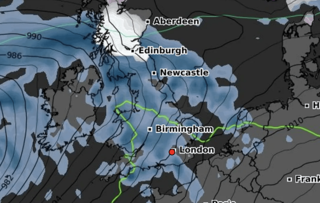
The Met Office has issued an urgent yellow weather warning as up to 10cm of snow is forecasted to blanket parts of northern and central Scotland overnight. The warning, spanning from 3am to 9am on Friday, indicates potential travel disruptions as wintry conditions grip the region.
Regions likely to be affected include Central, Tayside and Fife, Grampian, Highlands and Eilean Siar, and Strathclyde. According to meteorologists, snowfall is anticipated to intensify, particularly over higher ground, before gradually easing off during the morning hours.
A Met Office spokesperson elaborated, stating, “Accumulating snow is expected mainly above approximately 200 meters, with a possibility of temporary accumulations at lower levels during periods of heavy precipitation. Elevations above 250 meters could see 2-5 cm of snow, with isolated areas experiencing settling at lower altitudes. Accumulations of 10 cm or more are anticipated above 300 meters.”
In addition to the snow warning, a separate yellow weather alert for rain has been issued, effective from 2am to 9am on Friday. Heavy rainfall is forecasted across the Central Belt, affecting cities such as Edinburgh, Glasgow, and Stirling. Projections suggest precipitation levels of 15-25 mm, with localized areas receiving up to 35 mm overnight.
Looking ahead, forecasters anticipate windy conditions over the weekend, prompting another yellow weather warning for wind from 8am to 10pm on Saturday. A deep area of low pressure is expected to usher in gusts of up to 50 mph across western areas, with coastal regions potentially experiencing gusts of 60 to 70 mph along with large waves.
As the weather warnings remain in place, residents are advised to stay updated on the latest forecasts and take necessary precautions to ensure their safety during adverse weather conditions.