The UK is bracing for the arrival of Storm Babet, the second named storm of the season, set to bring a deluge of rain and destructive 60mph winds. Meteorologists warn that the storm could lead to building collapses and widespread disruption.
The Met Office has issued yellow severe weather warnings spanning from Wednesday to Saturday, covering vast areas of Scotland, eastern Northern Ireland, the North East of England, Yorkshire, the East Midlands, and East Anglia. The warnings highlight the risk of flooding, dangerous driving conditions, and the potential for fast-flowing or deep floodwater to pose a threat to life.
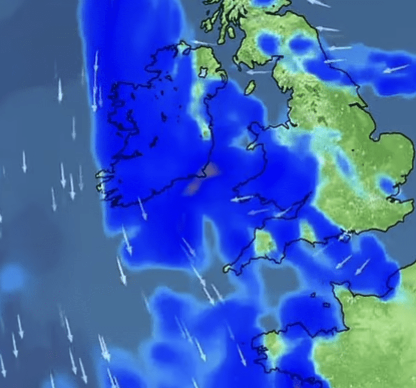
The onslaught of heavy rain is expected to commence tomorrow night, followed by storm warnings for eastern and northern England, southern Scotland, and Northern Ireland starting on Wednesday. The Met Office forecasts that these warnings will expand to cover nearly all of Scotland and extend until Saturday morning.
As the rain system advances northward, it will stall over central and eastern parts of Scotland, leading to persistent heavy rainfall from Thursday through Saturday. Parts of Scotland, still recovering from recent floods, are likely to be severely affected, with some highland areas accumulating up to 200mm (8in) of rain.
Scotland typically receives 168mm (6.6in) of rainfall in October, but this storm is expected to surpass that amount in just a few days. Parts of England may also witness substantial rainfall, with some isolated areas potentially experiencing up to 150mm (6in).
Meteorologists at the Met Office emphasized the importance of staying informed about flood warnings from local authorities and flood warning agencies. He also noted that Storm Babet would bring strong winds, particularly to eastern and northern Scotland, with gusts exceeding 60mph.
Meteorologists anticipate updates to the Met Office warnings throughout the week as the storm develops.
More news from Highland