Storm Lilian Set to Batter Northern Britain with 80mph Winds and Torrential Rain
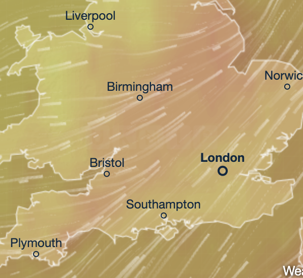
Brace yourselves, Britain! Storm Lilian, the 12th named storm this season, is due to slam northern England, north Wales, and southern Scotland overnight into Friday. Expect fierce winds gusting up to 80mph and heavy downpours that could trigger flooding and chaos as millions gear up for the August Bank Holiday.
Severe Weather Warnings Issued Across Northern UK
The Met Office has unleashed multiple yellow weather warnings. Heavy rain alerts cover south-west Scotland and the Aberdeenshire coast from Thursday night through Friday morning. Meanwhile, northern England and north Wales face high wind warnings.
Met Office meteorologist Jason Kelly warns: “Storm Lilian will bring some potentially damaging gusts during Friday morning, with widespread gusts of 50-60mph and possible spikes over 75mph in spots.”
The rain is set to hit already saturated ground in Scotland, raising the risk of surface water flooding. The Scottish Environment Protection Agency has slapped 21 flood alerts on regions including Orkney, the Western Isles, and Dumfries and Galloway.
Bank Holiday Travel Plans Could Be Wrecked
Just as 19.2 million Brits prepare to hit the roads this Bank Holiday weekend—the busiest since 2015—the timing couldn’t be worse. Friday alone expects 3.2 million car journeys. Storm Lilian is forecast to push into the North Sea by late Friday morning, but its aftereffects will leave northern areas dealing with unsettled weather.
The Met Office warns of:
- Travel disruption
- Power outages
- Flooding along coastal and low-lying areas
Unsettled August Weather to Continue
August has been a right washout already, with windy, wet weather especially across the northwest thanks to remnants of Hurricane Ernesto. Deputy Chief Meteorologist Nick Silkstone adds:
“Early Saturday will likely see heavy rain across southern and southeastern England, clearing by mid-afternoon with just a few showers later. From then until Monday, many southern and eastern areas will be dry but temperatures will hover around or just below average.”
Meanwhile, the northwest faces more unsettled spells of rain and strong winds, adding to a soggy month so far.
Weather Brightens Up After Storm Passes
Despite the stormy start, a mini-heatwave is on the horizon for next week, bringing warmer and sunnier spells to much of England after the storm clears. Still, campers, festivalgoers, and holidaymakers are urged to prepare for a wet and blustery Bank Holiday.
Stay tuned to the Met Office for the latest warnings and travel updates as Storm Lilian barrels through.