Southern England Braces for More Soaking Showers and Thunderstorms
Parts of southern and eastern England are gearing up for more soaking rain and thundery showers. After a drenched week leaving rivers full and grounds waterlogged, the wet weather is set to roll on – and it could cause some serious disruption.
What Could Go Wrong?
- Flood risk threatens homes and businesses, with potential property damage.
- Train and bus services may face delays or cancellations in flooded areas.
- Roads could be slippery and flooded, leading to tricky driving conditions and possible closures.
- Power cuts and service disruptions are possible for some households and firms.
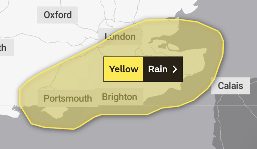
Heavy Rain and Strong Winds on the Way
The Met Office has extended the weather warning through to Sunday. Expect 15-30mm of rain across much of the region, with coastal spots near the English Channel hammered with up to 70mm. Plus, strong winds hitting 45-55 mph will buffet exposed coastal areas overnight Saturday into Sunday.
Stay Alert and Stay Safe
Those living or travelling in the affected zones should keep a close eye on weather updates and local warnings. Drive with caution, especially on wet and flooded roads. And if your home is in a flood-prone spot, get ready – the storm isn’t over yet.
The Met Office will keep monitoring the weather and issue fresh updates as needed. Stay safe and stay tuned.