
Freeze Alert: Met Office Warns Kent of Sleet and Frost
Severe Weather Warning Hits North and West Kent
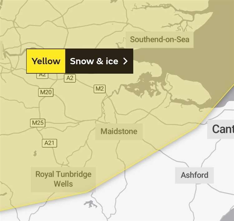
The Met Office has slapped a new icy weather warning on north and west Kent, including Maidstone, Medway, and Sheerness. The alert kicks in from 9pm tonight and lasts until 10am tomorrow, signalling wintry disruption across the region.
Snow and Sleet Expected as Temperatures Plunge
Earlier today, the UK Health Security Agency (UKHSA) and Met Office flagged a level two cold weather alert for the South East, running until midnight Thursday. Tunbridge Wells and Sevenoaks are bracing for light snow, while sleet is set to mar many other areas.
Dartford and Dover will face sleet showers on Tuesday and Wednesday, ditching snow for now. Meanwhile, Medway, Thanet, and the Isle of Sheppey can also expect sleet despite some forecasts hinting at snow chances.
Kent Council Urges Vigilance for Vulnerable Residents
Kent County Council is sounding the alarm for locals to check on vulnerable family, friends and neighbours. Temperatures could nosedive to -3°C, with widespread frost, ice patches, and wintry showers set to hit hard.
“Cold weather can affect anyone,” warns KCC director of public health Dr Anjan Ghosh. “The elderly, frail, and those with health issues are most at risk – from heart attacks and flu to falls and hypothermia.”
“It’s vital people keep warm during this cold snap, even if just heating the bedroom and living room. Look out for vulnerable neighbours and pitch in to support the community.”
Winter Woes Expected to Return After December Chaos
Last December’s heavy snow caused chaos across Kent, leading to numerous road accidents. This week, temperatures remain below average, especially at night, stoking fears of more accidents and health risks.
Every winter, thousands more deaths than usual are linked to cold snaps. The Met Office and UKHSA’s alerts trigger NHS and social care actions to protect those at greatest risk.