London Could Face Heavy Snow Next Week!
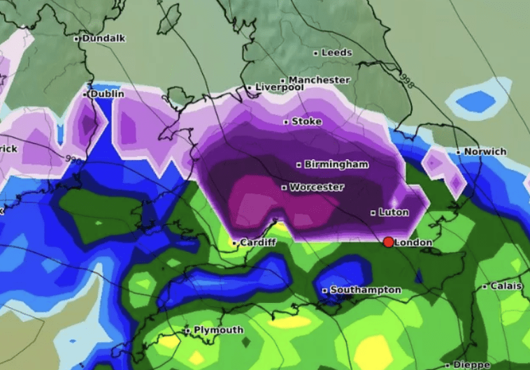
Just days after London’s first snowfall of 2024 on January 8, new forecasts suggest the Big Smoke might get hit with another icy blast. A recent weather map from WXCharts reveals a major snow event could be on the horizon for Tuesday, January 16.
Snow to Sweep in from the English Channel
The WXCharts map shows a hefty wall of snow pushing northeast from the English Channel, set to slam Kent before making its way into London. South East England could see the heaviest snowfall around noon, with thick purple shading on the map signalling heavier snowfalls. A lighter band of snow, marked in blue, will likely follow.
Freeze Warning: Temperatures to Plummet
Temperatures are expected to hover near freezing at 2°C during the snowfall. But not all forecasts agree. BBC 1 predicts a brighter picture with “sunny intervals and a gentle breeze,” expecting highs of 6°C and lows of 1°C in London. Meanwhile, the Met Office issues a cautious note about a “very small risk of snow” in some southern spots, keeping locals guessing.
With the forecast a week away, details could change—so Londoners, keep those boots ready and eyes on the sky!