Britain on High Alert for Early ‘Beast from the East’
The Met Office has slammed Britain with an Amber weather warning, forecasting up to a foot of snow in parts amid a brutal -12C Arctic snap. The cold blast is gripping the UK and has forecasters worried about a potential early winter “Beast from the East” making a comeback next month.
Amber Alert for Yorkshire and More Snow on the Way
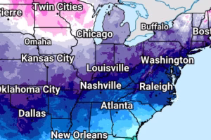
- An amber warning is in effect for the North York Moors and Yorkshire Wolds, with heavy snow and icy conditions expected.
- Yellow warnings cover northern and southwest England, Northern Ireland, Wales, and much of Scotland.
- Higher ground in Scotland and northeast England face up to 25cm (nearly a foot) of snow.
- London may avoid snow but will see temperatures dropping as low as -1C tomorrow night.
Met Office Chief Forecaster Sounds the Alarm
“Cold Arctic air from the north is firmly in charge of the UK’s weather, bringing the first notable cold snap of this autumn and giving an early taste of winter,” said Met Office Chief Forecaster Neil Armstrong.
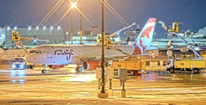
He added that snow and ice are major hazards, particularly on Wednesday and Thursday. “Wintry showers will hit Northern Ireland, southwest Wales, southwest England, northeast England and northern Scotland,” Armstrong warned. “Higher ground in Scotland could see 15-20cm of snow, and up to 25cm in Yorkshire.”
Sub-zero lows are expected across rural Scotland, dropping to -11°C on Thursday night, with widespread ice making travel treacherous.
Is Another ‘Beast from the East’ on the Horizon?
The Met Office revealed the potential for a Sudden Stratospheric Warming (SSW) event in the coming weeks – a phenomenon that triggered the infamous Beast from the East freeze and heavy snow chaos in 2018.
SSW causes the upper atmosphere winds to shift, dragging icy easterly winds into the UK and blocking out the milder Atlantic air. This can lock the country into freezing conditions for weeks.
“This year there is a signal for sudden stratospheric warming very early in the season,” said Met Office spokesman Stephen Dixon. “It suggests a higher chance of a cold start to winter, though precise impacts remain uncertain.”
More Wintry Weather Expected This Week
Met Office meteorologist Alex Burkill explained that cold Siberian air is crossing the Arctic Ocean and hitting the UK. Showers of rain, sleet, and snow are forecast across Scotland, Northern Ireland, northern and western England and Wales.
“Icy patches will cause slippery conditions, with snow accumulations ranging from 2cm to 10cm, especially on high ground,” Burkill said. “Temperatures will dive well below average, making this week markedly colder than last.”
Prepare for Bone-Chilling Conditions
- Amber warning in Yorkshire active from 5am to 9pm Thursday.
- Yellow snow and ice warnings remain across much of northern Britain until Thursday.
- Temperatures could plunge to -12C in rural Scotland by Thursday night.
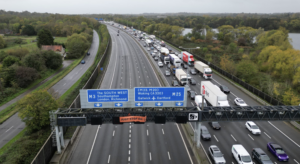
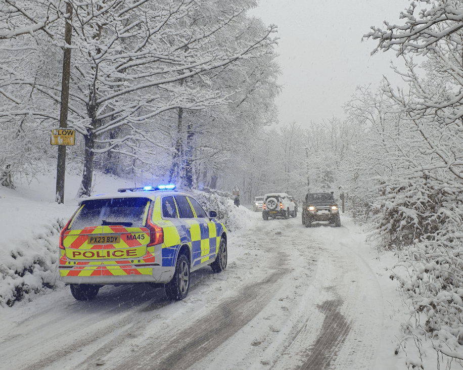
- Commuters urged to expect hazardous roads and travel delays due to ice and snow.
Stay tuned for updates as Britain braces for its earliest big freeze in years.